Reteaua EMSO - EUXINUS
Description |
Type |
Manufacturer |
Weather station |
u[sonic]WS6Mobus |
Lambrecht |
Modern acoustic telemetry for communication with the bottom system |
ATM-916 LF |
Teledyne Benthos |
Modern radio for communication near the beacon |
RUTX10 |
Teltonika |
Dissolved oxygen sensor |
RBRcoda T.ODO |
RBR |
Pressure sensor |
RBRCTD |
RBR |
Current sensor |
Aquadopp 300 Current Meter |
Nortek |
Conductivity sensor |
RBR CTD |
RBR |
Temperature sensor |
RBR CTD |
RBR |
Submersible chlorophyll sensor |
Turner Cyclops (Chlorophyll a) |
Turner |
Turbidity sensor |
Seapoint Turbidity Meter |
Seapoint |
Active Radar Reflector |
Active-X |
Echomax |
Passive radar reflector |
Mobri Type S2 |
Mobri Dk |
Weather station |
u[sonic}WS6 Modbus |
Lambrecht |
Power box including beacon electronics |
N.A. |
OE |
Acquisition system and data management software with low consumption |
Matrix 518 |
Artila Electronics |
Signal light |
M850 |
Carmanah/Sabik |
Status sensors |
N.A. |
Arel |
Inclination and compass sensors |
DCM26OB |
Rion |
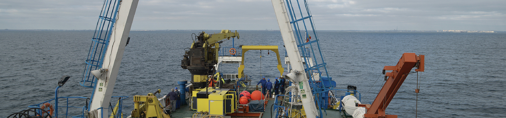
The three complex beacons named EuxRoOB1, EuxRoOB2 and EuxRoOB3 are located on the Romanian continental shelf, in the territorial waters of Romania, at a distance of approximately 160 km from the coast. Their placement was approved by the Ministry of National Defense, through the General Staff of the Naval Forces, represented by the Maritime Hydrographic Directorate (DHM). The transmission of data collected from the installed sensor systems is done acoustically, in real time. These data are transmitted to the surface beacon, then by satellite, in real time, to the EUXINUS Marine Natural Hazards Monitoring and Alarm Center, in Constanța.
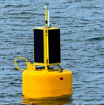
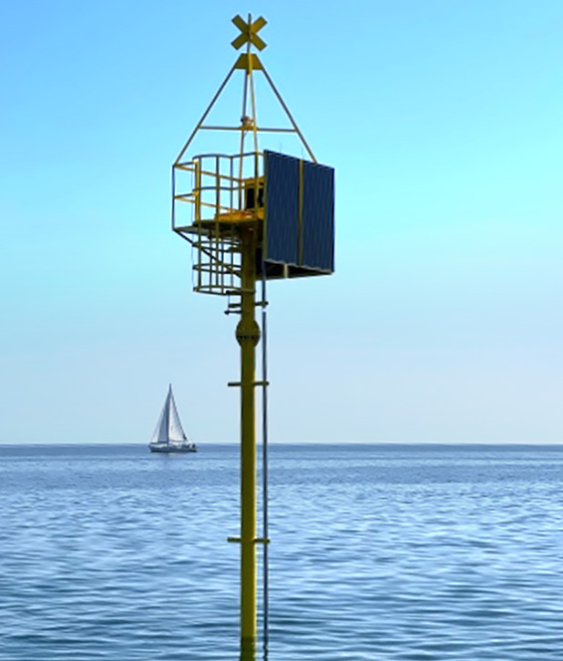
Coastal stations, located in the area of Mangalia EuxRoCB3, Constanta EuxRoCB2 and Delata Danube (Sulina) EuxRoCB3, at a water depth of 15 m, being equipped with:
Cod ST |
Description |
Type |
Manufacturer |
B.5. |
Weather station |
u[sonic]WS6 Modbus |
Lambrecht |
B.6. |
Current meter for waves and tides ADCP |
ADCP ADCP AWAC 1 MHz |
Nortek |
B.7. |
Water temperature sensor |
RBR CTD |
RBR |
B.8. |
Water pressure sensor |
RBR CTD |
RBR |
B.9. |
Water current sensor |
Aquadopp 300 Current Meter |
Nortek |
B.10. |
Conductivity sensor |
RBR CTD |
RBR |
B.11. |
Oxygen sensor |
RBR CTD RBRcoda T.ODO |
RBR |
B.12. |
Turbidity sensor |
Seapoint Turbidity Meter |
Seapoint |
B.13. |
Submersible chlorophyll sensor |
Turner Cyclops (Chlorophyll a) |
Turner |
B.14. |
Autonomous power system |
N.A. RBRtridente bb.Chl-a.fDOM |
Various |
B.19. |
Oil pollution sensor |
Turner Cyclops (Chlorophyll a) |
RBR/Turner |
B.20. |
Hydrophone |
RB9-ETH icListen |
Ocean Sonics |
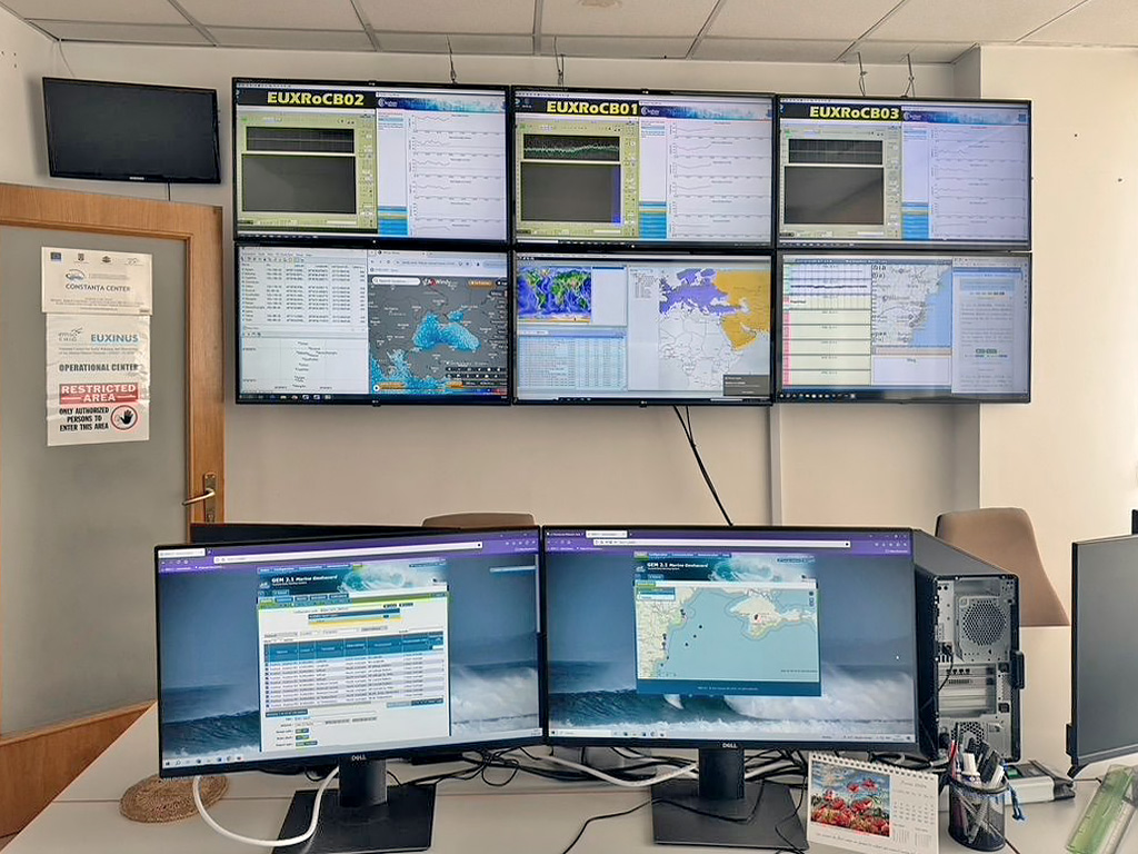
The Coordination Center for Receiving, Processing Data and Presenting Information, operates continuously (24h / 7 days) and ensures the automatic operation of detection and monitoring stations, collection and real-time processing of data transmitted by equipment installed in the system and transmission of alarm notifications in the event of a dangerous event. It is equipped with hardware, communication systems and specialized software applications. Specialized Software Systems (Tsunami Analysis Tool, Probabilistic and Evolutionary Early Warning SysTem, GEM 2.1) for assessing the consequences of marine geohazards provide the following functions: - interconnection of marine seismic data networks in Romania and Bulgaria; - automatic operation of tsunami detection stations; - receiving and storing in real time the monitoring data provided by the installed equipment, but also the data on seismic events provided by other monitoring sources; - development of scenarios for the generation and propagation of tsunami waves, and estimation of floodable coastal areas; - generation of maps in standard GIS format.